Company Profile
Mission
100% Farmer satisfaction.
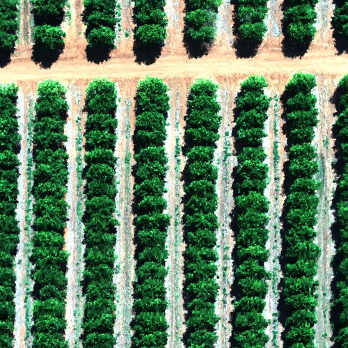
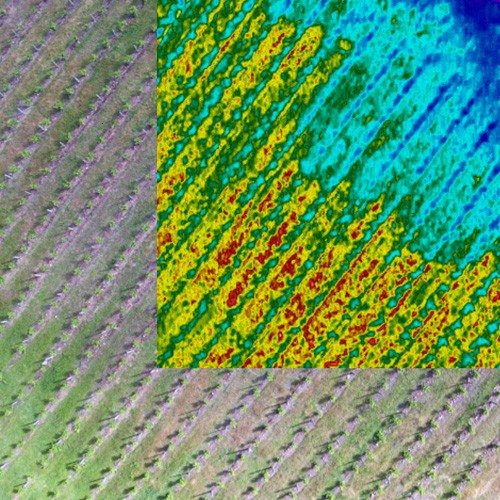
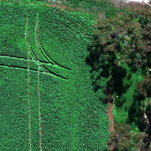
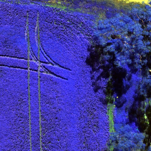
With our airborne hyperspectral sensors, we can uncover crop and plant stress that isn’t visible with conventional aerial surveys. Add to this modern data investigative techniques and advanced machine learning, we uncover farm savings through reducing your use of fertiliser, pesticides, herbicides, diesel and time. Our competitive rates ensure net savings to our clients.
Capability Statement
Why is AirborneLogic different?

We listen to you

We embrace new technology and new thinking

We integrate resources

Data management
Core Values
Experience and understanding of agribusiness
In today’s competitive market, businesses must work collaboratively to achieve successful outcomes. Agriculture is no different. Growing and harvesting a valuable crop requires teamwork with specialist partners. With our scientific, analytical and technical expertise, AirborneLogic is in a unique position to effectively partner with farmers in confronting the challenges of the agricultural sector.
Our team has over a century combined experience in agriculture and land management. Throughout our journey we have gained much, but are always seeking to implement our knowledge to effectively assist the agricultural sector.
We achieve this by sharing our knowledge with you through thoroughly understanding the decisions and actions you undertake. In doing so, we deliver effective and cost-saving solutions.
Team Profiles

Andy Chambers
Managing Director, AirborneLogic Pty Ltd
Andy is an experienced environment, water and sustainable agriculture manager, innovator and thought leader.
Andy’s career spans over thirty years including government experience in forestry, water resource, natural resource management, water allocation and waste water risk planning as well as over twenty years in environmental and sustainability consultancy. As a business owner he understands what businesses sustainability means but also brings the context of deep experience in land and sustainable agriculture. Now fusing this with a team of technology and computing experts, Andy is leading the charge to ensure agritechnology R&D can be commercialised for the benefit of landholders.

Mike Barnes
Senior Spatial Analyst
Mike has a strong interest in data management, automated data processing and machine learning. With work history including several years at a commonwealth science agency and time with energy companies, he has seen a number of data pipelines ranging from good to bad and is taking those learnings onboard to ensure AirborneLogic’s workflows and systems generate accurate, repeatable results as quickly as possible. He has tertiary qualifications in GIS, remote sensing, geology & geophysics.
Accreditation
AirborneLogic abides by all necessary Civil Aviation Safety Authority (CASA) regulations. Our drone pilots are all licensed and hold Remote Pilot’s Licence (RePL) in each class for sub 7kg and sub 25kg and AirborneLogic holds a ReOC (Remote Operators Certificate) and is authorised by CASA to utilise drones as a commercial business. AirborneLogic is committed to ensuring safe skies and we develop detailed site risk plan and operations in collaboration with our clients and CASA as needed.